Women in ITE - Blog
Each month we will explore a new topic that contributes to safe, equal opportunities in the transportation profession and the communities we serve. The sidebar shows a tentative schedule for topics
Monthly Topics
- May 2026
Full Speed, Empty Tank: Addressing Burnout in the Transportation Industry - April 2026
Communicating With the Public: Building Stronger Communities Through Meaningful Engagement - March 2026
Integrating Drone Technology for Safer, Smarter, Faster and More Efficient Project Delivery - February 2026
Work Zone Safety Action Plan: A Roadmap to Safer Travel for All - January 2026
Building on 2025 Momentum and Looking Ahead to 2026 - All 2025 Blogs
- All 2024 Blogs
- All 2023 Blogs
- All 2022 Blogs
- All 2021 Blogs
- All 2020 Blogs
- All 2019 Blogs
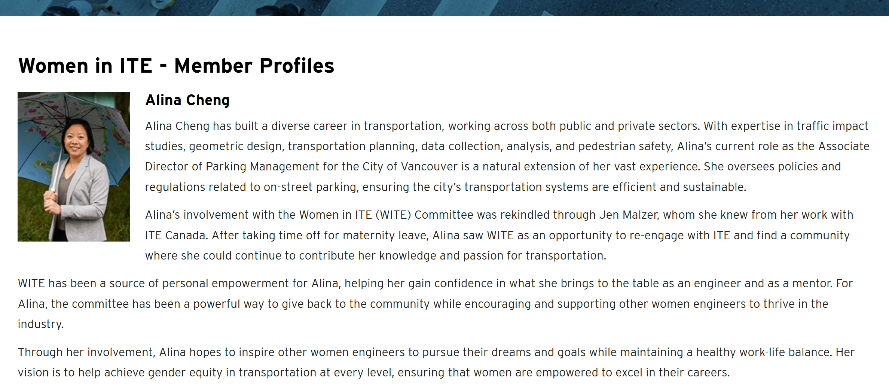
I joined this committee when I realized we could make a difference – so much great work is out there. -Jen Malzer, Canadian District
I joined this committee because I remember being the only female engineer in many settings early in my career. I was fortunate enough to have great mentors surrounding and supporting me. I want to help other engineers have the same level of confidence that I was able to experiences. - Angela Garland, P.E., PTOE, RSP1
Full Speed, Empty Tank: Addressing Burnout in the Transportation Industry
 Transportation professionals play a vital role in shaping how people and goods move through our communities. From designing safer intersections and managing traffic flow to planning multimodal networks and long-range infrastructure investments, our work directly impacts quality of life, economic vitality, and public safety. Many of us are motivated by a passion for improving society, safety, and connectedness. Yet behind this essential work lies a growing challenge that is less visible but deeply felt: burnout.
Burnout in transportation professions often stems from sustained high workloads, tight deadlines, and the pressure to balance technical accuracy with public expectations. Projects frequently involve conflicting interests, evolving regulations, community input, and limited funding, all of which can complicate decision-making and extend timelines. Long-term projects combined with shifting client expectations or regulatory requirements can also create a sense that the work is never truly “done.” Over time, these demands can lead to mental fatigue, reduced motivation, and even a loss of passion for the work.
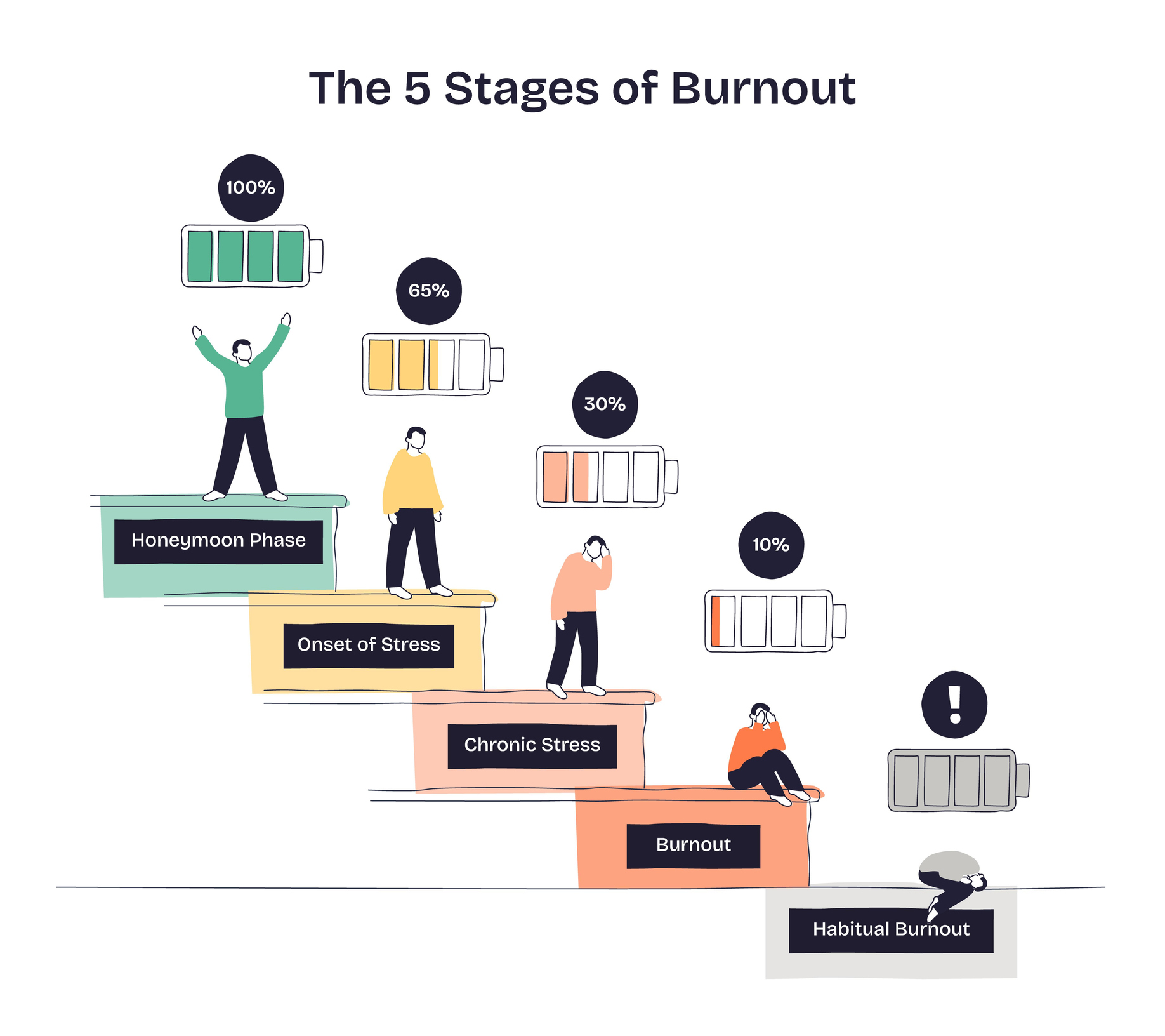 Culture within many transportation organizations often contributes to burnout. There can be an unspoken expectation to manage competing priorities, appease everyone, respond quickly to issues, and keep projects moving forward regardless of constraints. Public meetings, deadlines, and constant coordination can create a fast-paced, high-pressure environment. Remote work and digital connectivity have blurred the boundaries between professional and personal life, making it increasingly difficult to fully disconnect and recharge.
Coping with Burnout: What Individuals Can Do
- Set boundaries: Establish clear start and stop times for work, and resist the urge to constantly check emails or project updates after hours.
- Prioritize and communicate: Not every task is urgent. Work with supervisors to clarify priorities and realistic deadlines.
- Take intentional breaks: Short walks, stepping away from screens, or even brief mental resets during the day can improve focus and reduce fatigue. Don’t be afraid to block time on your calendar for this. When working from home, my dog’s mid-day walk time is on my calendar.
- Invest in recovery: Use vacation time, maintain hobbies, and prioritize sleep and physical health to recharge.
- Seek support: Talking with colleagues, mentors, or supervisors about workload challenges can often lead to solutions and shared understanding.
- Learn to Say No: It’s necessary! Keep in mind that every new task or project takes time away from something else. Learn to prioritize the most important tasks that you can devote high-quality energy. Overcommitting takes a toll on your well-being (including those around you), lowers quality of work, and can result in missed deadlines.
Coping with Burnout: What Employers Can Do
- Promote realistic workloads: Avoid chronic over-allocation and ensure staffing aligns with project demands. Encourage supervisors to have regular conversations with staff about priorities and workloads.
- Encourage time off: Normalize taking time off (even for mental health days) and discourage a culture of constant availability.
- Foster open communication: Create an environment where employees feel comfortable raising concerns without fear of judgment.
- Provide flexibility: Hybrid schedules or flexible hours can help employees better manage personal and professional responsibilities.
- Support professional development: Offering training and growth opportunities can help re-engage employees and restore a sense of purpose.
- Reward: Reward your employees for their hard work and find opportunities for team bonding. It’s important to ask employees what aligns with their interests – nobody wants a mandatory “fun” event that feels like more “work.”
Ultimately, sustaining a long and fulfilling career in the profession depends not only on technical skill, but also on maintaining balance. Recognizing burnout early—and taking steps to address it—can help ensure that transportation professionals continue to do what they do best.
If you’re passionate about mental health in the transportation industry, join ITE’s newly formed Mental Health Working Group to help make a significant impact in our community. Please express your interest by filling out the Google Form here: Google Form.
Communicating With the Public: Building Stronger Communities Through Meaningful Engagement
Through my experience managing complex, high-profile transportation projects, I’ve learned that technical excellence alone isn’t enough – success is truly driven by building strong, authentic relationships. These relationships go beyond just our clients and public agencies; they include the entire community: residents, local leaders, and anyone affected by the project. I see community outreach as a unique opportunity to deepen mutual understanding and foster genuine empathy with these key groups. It’s this ongoing process of connecting and learning that makes community engagement so rewarding for me.
Effective public communication shouldn’t be just a box to check on a project to-do list – it’s fundamental to shaping solutions that genuinely reflect a community’s needs, values, and lived experiences. Whether we’re planning a transportation corridor, reimagining a neighborhood, or developing long-range mobility strategies, project success often depends on how well we involve communities throughout the process.
Over the past several years working on complex, high?visibility projects - from community-based transportation plans to multimodal corridor studies - one theme has emerged repeatedly: when people see themselves in the plan, they support the plan. That starts with thoughtful, equitable, and transparent engagement.
Below are key principles and practical strategies for doing this well.
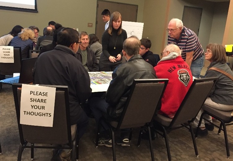
Meeting People Where They Are – And Listening First
.jpg) Traditional public meetings have their place but reaching a broad and representative audience requires meeting people in the environments where they feel comfortable and heard.
Traditional public meetings have their place but reaching a broad and representative audience requires meeting people in the environments where they feel comfortable and heard.
That means:
- Pop?ups and “pop?ins” at schools, transit hubs, grocery stores, community centers, farmer markets, and neighborhood events
- Scheduling small group discussions or listening sessions, one-on-one interviews with community leaders or caregivers
- Culturally responsive formats designed with community?based organizations (CBOs)
 Choosing days and times that align with community rhythms—not agency convenience
- Designing events around incentives that matter to participants (such as on-site childcare, food, stipends, interpretation, gift cards, transit passes)
- “Inclusivity by Design” – Plan engagement with diverse users in mind from the start, not as an afterthought.
- Representation across gender, age, race, ability, and income is essential to genuinely reflect the community.
As a member of the Women in ITE committee, I’ve seen firsthand how women in transportation often bridge the gap between technical teams and communities. They facilitate empathetic, trust-based conversations and blend analytical expertise with a human-centered approach. This methodology is particularly crucial when working with Equity Priority Communities (EPCs), where trust in public institutions may be low due to historic underinvestment or past negative experiences.
Make Communication Clear, Accessible, and Multilingual
A project is only as understandable as the language used to explain it. That’s why “plain?language” communication is one of the most powerful tools in public engagement.
Effective strategies include:
- Avoiding technical jargon
- Using visuals, storyboards, and infographics to simplify complex design concepts
- Providing materials in all languages spoken in the study area
- Ensuring accessibility for individuals with limited English proficiency or disabilities
Multilingual communication isn’t just a courtesy – it is a requirement for equitable participation.
Build Trust Through Partnerships, Not PowerPoint
.png) Communities respond best when engagement moves from “informing” to co?creating.
Communities respond best when engagement moves from “informing” to co?creating.
A trust?centered model involves:
- Early collaboration with CBOs as equal partners in outreach
- Vetting messaging with community leaders to ensure authenticity
- Using community trusted messengers - not just project staff - to convey information
- Acknowledging community concerns and addressing them transparently
Trust is especially important when working with communities who may be undocumented, low?income, or historically marginalized. The goal is not simply engagement - it is relationship?building.
Use Toolkits and Structured Strategies to Stay Consistent
Effective engagement doesn’t happen by chance. Many organizations now use communications and engagement toolkits that include:
-
Standardized messaging (“boilerplate”) that explains the project’s purpose and benefits
- Outreach templates for email, social media, flyers, and workshop materials
- A stakeholder and CBO inventory with preferred communication channels
- Guidelines for designing inclusive and equitable engagement events
A toolkit helps ensure consistency across the project team, including partners, subconsultants, and client agencies.
Engagement Is a Conversation, Not an Event
Communities expect to see how their input shapes the outcome. This means the engagement process should be cyclical:
-
Listen – gather insights through surveys, workshops, interviews, and events
- Reflect – synthesize what was heard and report it back
- Adapt – show what changed in response
- Re-engage – refine the plan with communities at every stage
An iterative model builds confidence that participation is not symbolic but meaningful.
Leverage Technology to Expand Your Reach
Digital engagement does not replace in?person interaction – but it meaningfully complements it.
Tools can include:
- Online open houses
- Interactive maps and comment boards
- Webinars with live Q&A
- Project web sites
- Social media micro?engagement
- AI?supported analysis
- Slido, Mentimeter, and Kahoot for online participation
Other widely available tools include Survey Monkey, Google Forms, Qualtrics that can provide basic summaries of data received.
.png) Additionally, specialized tools such as Mott MacDonald’s Moata Community Insights help make sure every community member’s input is heard; not getting lost in volume. The tool keeps a clear record of all engagement, preserving important information as the project moves through different stages. It uses data and location-based insights to help project teams better understand what the community needs and what impacts their work may have. This understanding enables them to tailor and improve public outreach and engagement efforts.
Additionally, specialized tools such as Mott MacDonald’s Moata Community Insights help make sure every community member’s input is heard; not getting lost in volume. The tool keeps a clear record of all engagement, preserving important information as the project moves through different stages. It uses data and location-based insights to help project teams better understand what the community needs and what impacts their work may have. This understanding enables them to tailor and improve public outreach and engagement efforts.
Plan Engagement with Purpose and Clarity
Strong community engagement begins with a clear framework:
- What are the goals of engagement?
- Who are the priority audiences?
- What decisions can community input influence?
- What methods are best suited to each audience and phase?
- What metrics will define success?
Documenting this in a Public Outreach and Engagement Strategy ensures alignment with clients, the project team, and community partners from day one. Additionally, documenting this in the engagement plan to emphasize the importance of measuring how successful the effort was in reaching out to target populations. Effectively tracking and monitoring this would allow for pivoting if groups are identified that were missing from the early discussions.
Close the Loop – Show How Community Input Shaped the Project
One of the biggest frustrations communities express is not knowing whether their feedback mattered. Closing the loop means:
- Sharing “What We Heard” reports
- Explaining how input affected design decisions
- Communicating tradeoffs honestly
- Offering follow?up engagement opportunities
Transparency fosters goodwill, even when all community preferences cannot be accommodated.
In Conclusion
As women in transportation, we have a powerful role to play in shaping how projects listen to and learn from the communities they serve. That leadership shows up when we advocate for engagement that is properly resourced, thoughtfully planned, and treated as essential to good project delivery, not merely a box to be checked. It shows up when we push for outreach that is authentic, inclusive, and grounded in trust.
Just as importantly, it means recognizing empathy as a professional strength. Listening deeply, building trust, and translating complex ideas into meaningful conversations are not “soft skills” – they are essential competencies that lead to better decisions and more durable outcomes. By modeling these values, mentoring the next generation, and leading with both rigor and humanity, women in transportation can continue to raise the bar for what meaningful public engagement looks like and help build projects that communities truly see themselves in.
Let’s use our voices, influence, and mentorship to champion meaningful engagement – and lead the way in building transportation projects shaped by people, not just process!
Integrating Drone Technology for Safer, Smarter, Faster and More Efficient Project Delivery
Over the past several years, drones have become an indispensable tool across architectural, engineering, planning and marketing services. What began as a way to capture aerial photos has evolved into a comprehensive platform for documentation, analysis, design support, and client communication. Today, drones allow us to work safer, smarter, and faster while providing organizations with insights that were previously difficult or impossible to capture. Below is an overview of how drone photography, video, photogrammetry, and thermal imaging have elevated work efforts.
Drone Photography: A New Perspective on the Built Environment
Drone photography gives organizations the ability to observe, document, and evaluate sites and buildings with unprecedented clarity and efficiency.
Infrastructure Surveys
Drones allow for safe and quick documentation of hard?to?reach areas, large surfaces, and structural concerns and failures. This imagery supports both routine assessments and in-depth diagnostic work. High-resolution drone images play a key role in condition surveys, evaluations and infrastructure documentation. With these tools, organizations can maintain a consistent, accurate visual record throughout project lifecycles.
Traffic & Circulation Evaluations
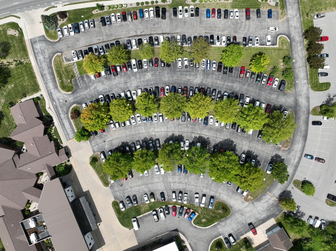
Drones are frequently used to assist with traffic studies, assessments and reports. From above, drones can observe traffic flow, turning movements, queue lengths, and conflict points without disrupting drivers or requiring staff to be on the road. Their ability to hover and maneuver at different altitudes allows organizations to collect comprehensive visual data across large areas, which can then be analyzed to understand patterns, identify congestion, and support transportation planning. This aerial perspective provides clearer, more accurate information than traditional ground?based cameras, making drones a valuable tool.

Interchange drone photo (CBB Transportation)
Drone photography has been especially valuable in K–12 school projects, where aerial images have been used to analyze arrival and dismissal patterns, pedestrian movements and vehicle congestion points. These comprehensive visuals provide schools and districts with a clear understanding of circulation challenges and help inform the development of safer, more efficient site?specific solutions.
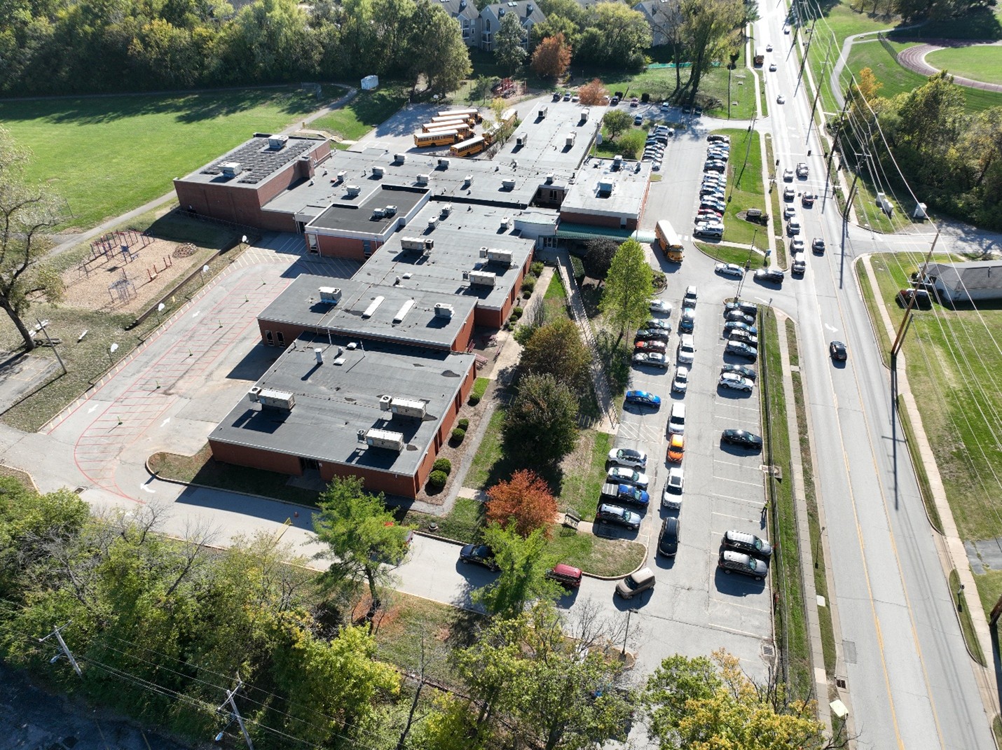
School circulation drone photo (CBB Transportation)
Design & Construction Support
Drones are successfully used for capturing visuals, documenting construction progress, assisting with site planning and design, and nighttime site photography to evaluate lighting and safety conditions. The ability to capture 360?degree panoramas also gives organizations an immersive view of a site before design even begins.
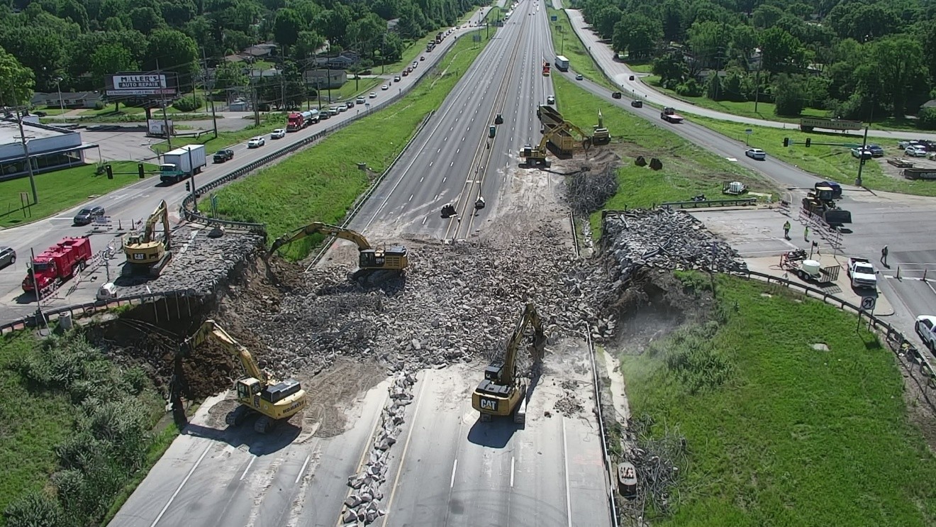
Demolition drone photo (CBB Transportation)
Drone Video: Insights That Photos Alone Can’t Provide
Drone video brings motion, context, and clarity to evaluations and planning work. It’s an accessible tool for communicating complex site conditions with clarity and precision.
Traffic Flow Documentation
Aerial video footage has emerged as a powerful tool for capturing real-time traffic conditions across a wide range of environments. By providing high?resolution views from above, drone technology enables detailed observation of parking activity, individual intersections, major interchanges, and small corridors. This approach significantly reduces the number of staff required in the field while offering reliable video documentation that can later be used to verify field notes or address questions that arise after site visits.
Drones are not only being used for visual assessments but also for data collection. This includes short?term turning?movement counts, and intersection delay studies. The ability to capture conditions safely and efficiently makes drones especially effective in complex or high?traffic environments.
More importantly, the video imagery offers a lasting reference that allows both technical and non?technical stakeholders to revisit and analyze a site long after the initial field visit.
Parking evaluation drone video still shot (CBB Transportation)
Construction Progress & Timelapse
Drone video is used for construction progress tracking and there is capability to create long-term timelapse sequences. For example, one project documented a six?month track and field reconstruction, providing the client with a powerful visual narrative of the project from start to finish.
Another project involved full days in the field at the Mystic Maffa Bridge Replacement DB, documenting the traffic congestion, signal operations and vehicle queues associated with the reconstruction of the Mystic Ave and Maffa Way Bridges over the MBTA Orange Line and Commuter Rail lines adjacent to Sullivan Square. During key phases of construction, when the Orange Line was shut down to facilitate construction, the impacts associated with Shuttle Buses traveling through the area were documented. This allowed a review of the footage in detail with managers in office to walk through key observations over the course of the day.
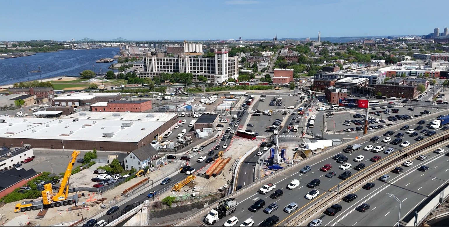
Construction Drone Image (Tetra Tech)
Photogrammetry: Turning Imagery Into Measurable 3D Intelligence
Photogrammetry has revolutionized the way organizations quantify and visualize sites. Using drone imagery, detailed digital models can be created that support planning, communication, and analysis.
High-Accuracy 3D Site Models
Virtual site models, building exteriors and interiors, high-definition 2D site maps, and conceptual AutoCAD contour files are examples of uses that are invaluable for early planning, feasibility studies, conceptual design, and communicating design intent to stakeholders.
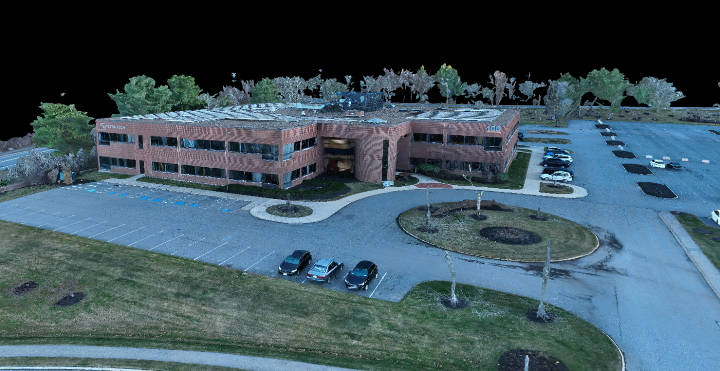
3D Model Drone Image (Tetra Tech)
Precision Measurements From the Office
Drone footage coupled with certain software allows organizations to take measurements with up to 96% accuracy compared to field measurements, significantly improving efficiency. Some of the newest drone equipment can even achieve up to 99% accuracy, an extremely powerful capability for planning and design. This resource is especially useful for surface area calculations, volume and material quantity take-offs as well as excavation tracking during construction.
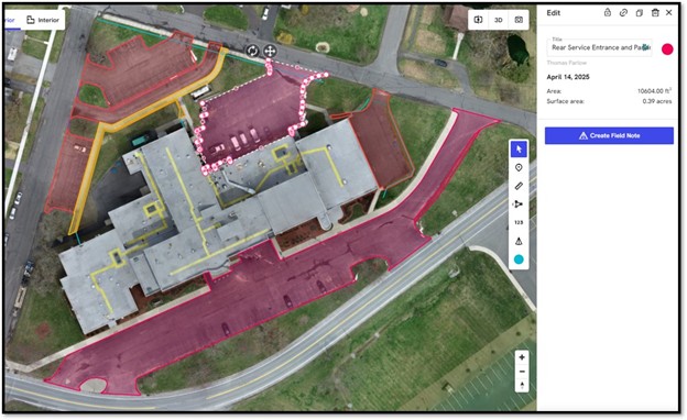
Photogrammetry Model Drone Image (Tetra Tech)
Compatibility with VR & Visualizations
Photogrammetry models can also be integrated into virtual reality experiences, renderings and high-quality visuals for client presentations.
Thermal Imaging: Seeing What the Eye Can’t
Thermal imaging extends drone capabilities into diagnostic and maintenance-focused applications providing the ability to identify issues hidden beneath the surface.
Infrastructure
Thermal cameras allow us to identify heat loss, moisture intrusion, insulation gaps, and leaks. Thermal imaging can also detect overheating components in electrical or mechanical systems, helping prevent failures and reduce maintenance costs. This gives owners a proactive way to maintain and improve energy efficiency.
Thermal imaging can even help locate buried pipes, subsurface drainage systems and septic system components. Disturbed soils and moisture patterns often reveal hidden infrastructure.

Thermal Imaging Drone Example (Tetra Tech)
Solar Panel Efficiency
For solar farms or rooftop installations, thermal imaging helps pinpoint damaged panels, underperforming modules and areas of energy loss. This supports long-term sustainability and system optimization.
Key Takeaways
As drone technology and analytical software continue to advance, they are becoming integral to data driven project delivery. What once required extensive field time, complex equipment, or difficult manual documentation can now be achieved more safely, more accurately, and in a fraction of the time. From high?resolution imagery and real?time video to 3D modeling and thermal diagnostics, these tools strengthen documentation, accelerate decision making, and enhance coordination across planning, design, and construction. By integrating drone-based data into engineering processes, organizations can achieve a higher level of precision, efficiency, and overall understanding of project conditions across the full project lifecycle.
Work Zone Safety Action Plan: A Roadmap to Safer Travel for All
Work zones are dynamic environments where construction, maintenance, and utility work intersect with everyday travel. With traffic volumes continuing to rise and work zone configurations becoming more complex, developing a thoughtful Work Zone Safety Action Plan (WZSAP) isn’t just good practice — it’s essential. FDOT District 7 in Tampa Bay has taken a comprehensive approach to this national challenge. This blog breaks down key elements of a safety action plan that works for practitioners and communities alike.
Why Focus on Work Zone Safety?
Work zones are inherently challenging. Temporary lane shifts, reduced speeds, and unexpected traffic patterns increase risks for both road users and workers. Rear-end and lane-change crashes dominate work zone incidents, especially on high-speed roadways. These crashes often stem from human behavior — delayed reactions, unexpected conditions, and lack of advance warning — but they can be mitigated through proactive planning and smart use of emerging technology.
By building a strategy that combines engineering, education, enforcement, encouragement, and evaluation, agencies can significantly reduce work zone crashes and create safer environments for everyone.
Key Strategies of a Work Zone Safety Action Plan
1. Education
Awareness is the foundation for safer work zones. Educating contractors, planners, enforcement partners, and the general public about work zone risk factors fosters a shared commitment to safety. This includes training on proper signage, temporary traffic control layouts, and the latest tools to monitor work zone performance.
2. Engineering and Design
Effective safety action plans start long before cones go out. This includes:
- Conducting Work Zone Road Safety Audits or Assessments during project planning and even during ongoing construction.
- Leveraging smart work zone tools such as dynamic lane merge systems, variable speed limits, and queue detection to proactively manage traffic.
- Ensuring temporary traffic control meets the latest standards and reflects real-time conditions.
Smart approaches — including portable sensors and computer vision — give agencies the ability to spot hazards and trends that traditional audits may miss.
3. Enforcement and Encouragement
Safety doesn’t happen in isolation. Partnering with law enforcement helps ensure compliance with work zone speed limits and traffic control devices. Public encouragement — through outreach campaigns and community partnerships — makes safety a shared responsibility.
Encourage drivers to slow down, stay alert, and follow posted work zone guidance. Highlight success stories and share data that explains how safer driving behavior protects both road workers and motorists. Consider the use of Geofencing messages to gather input from drivers as well as send information on the importance of safe driving through a specific work zone.
4. Evaluation and Continuous Improvement
A dynamic plan includes mechanisms to measure what’s working — and what’s not. This includes before-and-after crash analysis, speed monitoring, and reviewing near-miss data. Emerging analytics from smart work zone systems can help teams identify “leading indicators” (like sudden speed drops or close calls) that signal unsafe conditions even before a crash occurs.
Evaluation drives refinement of processes, technologies, and policies — turning data into actionable improvement.
Putting It All Together
A Work Zone Safety Action Plan isn’t a checklist — it’s a conscious approach to prioritizing people over projects. It combines thoughtful planning, smart technology, and strong communication to reduce risk and improve outcomes.
As traffic professionals, we have the tools — and the responsibility — to advance safety in every work zone, every day. Whether you’re a planner, engineer, contractor, or public outreach partner, embracing a collaborative action plan helps protect lives and builds trust with the communities we serve.
Get Involved
Have you implemented a successful work zone safety strategy? Or are you exploring innovative technologies for your next project? Share your experiences and insights in the comments — let’s learn from each other and keep moving toward safer roads for all.
Building on 2025 Momentum and Looking Ahead to 2026
As we welcome a new year, the Women in ITE (WITE) Committee is energized by the momentum built throughout 2025 and excited about the opportunities ahead. This past year reinforced the value of connection, shared learning, and creating spaces where women across transportation can grow, lead, and support one another.
A New Year Message from the Co-Chairs
 As Co-Chairs, we’ve had the privilege of watching WITE continue to grow into a space that blends professional development with community, creativity, and connection.
2025 reinforced just how important momentum and engagement are to the strength of WITE. This past year, we truly felt that energy through strong participation in our bootcamps, thoughtful blog contributions, and the growing engagement with our Member Profiles. Every conversation, shared story, and moment of involvement, both big and small, helped shape a committee that feels connected, welcoming, and meaningful.
As we move into 2026, we’re excited to build on that foundation by creating even more ways for members to get involved, amplifying diverse voices across our community, and continuing to strengthen the connections among women throughout ITE. Our hope is that WITE remains a place people are excited to be part of, where members feel supported, encouraged to participate, and comfortable growing in ways that feel right for them.
Together, we’re looking ahead to a year rooted in collaboration, visibility, and shared purpose. We can’t wait to see what 2026 brings for WITE and our community.
Reflecting on 2025: A Year of Growth and Connection
Throughout 2025, WITE focused on offering bootcamp, content, and opportunities that supported professional growth while fostering a strong sense of community.
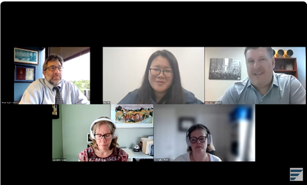
The Women in ITE Bootcamp Series remained a cornerstone of our efforts in 2025, offering hands-on learning experiences focused on practical skills and professional growth.
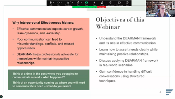 Interpersonal Effectiveness Tools
Focused on assertive communication strategies and navigating challenging conversations with confidence, including tools attendees could immediately apply in their professional and personal interactions.
 Navigating Career Growth: The Power of Coaches, Mentors, and Advocates
Explored the distinct roles of coaches, mentors, and sponsors, and how each can support career development at different stages. The session emphasized how to build and maintain these relationships from both sides.
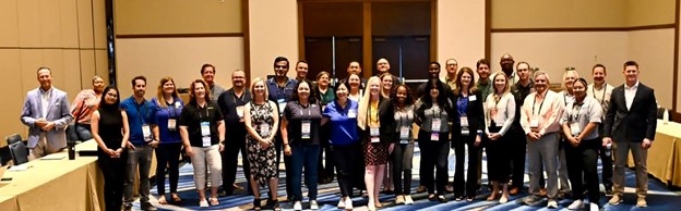
 The Art of Negotiation (2025 ITE Annual Meeting)
An interactive, in-person workshop that brought together professionals from across the transportation industry to practice negotiation strategies related to career advancement, project discussions, and workplace decision-making.
 In parallel, the Women in ITE monthly blog continued to serve as a space for reflection, learning, and creativity. Topics throughout the year included Women’s History Month, mental health, AI use in transportation, LeadershipITE experiences, negotiation strategies, community service, and seasonal features. Many of these posts were intentionally connected to WITE events and initiatives, helping extend conversations beyond live sessions.
 Another major milestone in 2025 was the launch of the Women in ITE Member Profiles initiative. Beginning in June, these monthly spotlights highlighted members’ backgrounds, experiences, and contributions to the profession. Shared on the WITE website and through ITE’s LinkedIn channels, the profiles strengthened visibility and fostered a deeper sense of connection across the community.
Looking Ahead and Getting Involved in 2026
Thank you to all of our volunteers in 2025! As we move into 2026, the committee is building on last year’s momentum while expanding into new areas of interest. Upcoming topics and initiatives include leadership development, mentorship and sponsorship, negotiation skills, practical applications of artificial intelligence, and safety-focused discussions such as work zone safety.
We’re also inviting members to get involved as volunteers in 2026. Opportunities range from helping plan Bootcamp sessions and contributing blog content to coordinating member profiles or supporting outreach efforts. Whether you have a little time or a lot, there’s a place for you to contribute and help shape what WITE offers in the year ahead.
As the new year begins, Women in ITE looks forward to continuing this work together, strengthening connections, sharing knowledge, and supporting one another along the way.
Want to stay connected? You can find our latest updates, monthly blog posts, and Member Profiles on the Women in ITE page.
Interested in volunteering in 2026? Please contact Kathi Driggs.